1932 - Bow Hill
|
This case was uncovered by Andy Thomas, who discovered it in an old copy of Sussex Notes and Queries, published by the Sussex Archaeological Society. We believe the publication date is 1937, but this is not clear. (It is, in any respect, obviously from an old publication and not a modern volume.)
This is an impressive case, for it provides:
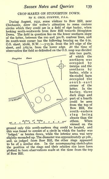
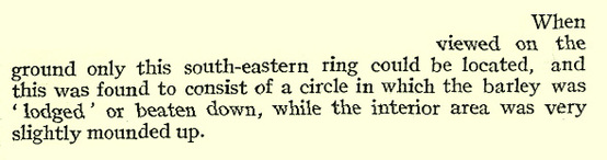
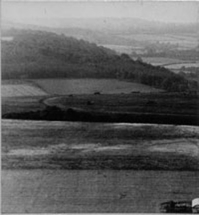
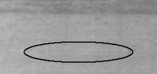
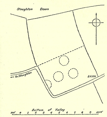
The photograph is the earliest crop circle photo currently known. It is shown below. It does not reproduce well, but a clearly defined ring is visible in the foreground at the bottom of the image. The diagram shows four rings (in no meaningful formation), but only one of them is a flattened crop ring, the others being markings visible in the plant colouration. The site description is again persuasive. The author of the piece is Eliot Cecil Curwen (1895-1967), a Sussex-based archaeologist and writer, and he reports as follows: "This [ring] was found to consist of a circle in which the barley was 'lodged' or beaten down." |
Photograph
|
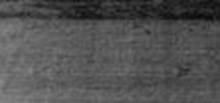
A detail from the main photo is shown below, and beneath it, another copy more clearly indicating the location of the flattened ring.
 |
The location today
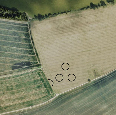
We have located the site of these rings, which is close to Stoughton, just to the north east of the village. The field boundaries have changed a little, but the site is still recognisable compared to Curwen's diagram.
There is a patch of hard ground where the barn once stood, which the current farmer has ploughed and sown around. There is also a trace of the old field boundary running south of the barn, visible through a line of slightly darker growth. We have marked on the approximate location of the 1932 rings.
There is a patch of hard ground where the barn once stood, which the current farmer has ploughed and sown around. There is also a trace of the old field boundary running south of the barn, visible through a line of slightly darker growth. We have marked on the approximate location of the 1932 rings.
 |
 |
IMPORTANT UPDATE ON CAUSATION - 2022
This case was considered one of the strongest in the historical record for the fact that not only was there a site description by someone who was there at the time, but also a photograph conforming to the ring he observed.
In 2022 I was contacted by Sussex-based researcher, Barry Reynolds, who did some follow-up work on this case and his findings are important in understanding what took place.
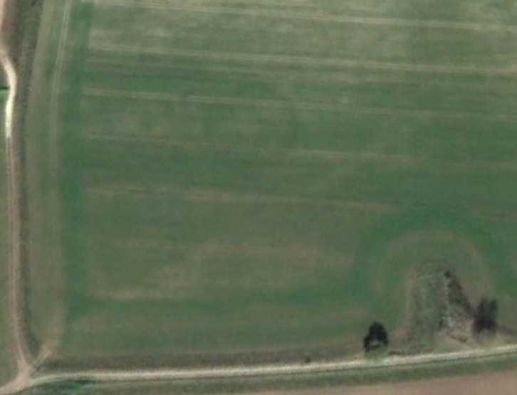
Barry surveyed some aerial images of the site at various points in time and found traces of the rings still visible in the fresh-growth crop. This was unexpected and fundamentally changes the situation. It emerged through further work by Barry that the 1932 crop rings were in fact a by-product of underground structures - ditches where round barrows were once constructed, now recorded by Historic England as "five or six ditches [which] may represent the location of a ploughed barrow cemetery".
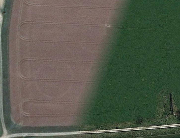
Images from Google Earth are shown below, one from October 2011 (left) and one from July 2019 (right). The rings are clearly visible in these images, although they do not show on other historical photos of the same field. There is no doubt the 1932 crop rings are an artefact of the underground structures, the presence of which they record.
In 2022 I was contacted by Sussex-based researcher, Barry Reynolds, who did some follow-up work on this case and his findings are important in understanding what took place.
Barry surveyed some aerial images of the site at various points in time and found traces of the rings still visible in the fresh-growth crop. This was unexpected and fundamentally changes the situation. It emerged through further work by Barry that the 1932 crop rings were in fact a by-product of underground structures - ditches where round barrows were once constructed, now recorded by Historic England as "five or six ditches [which] may represent the location of a ploughed barrow cemetery".
Images from Google Earth are shown below, one from October 2011 (left) and one from July 2019 (right). The rings are clearly visible in these images, although they do not show on other historical photos of the same field. There is no doubt the 1932 crop rings are an artefact of the underground structures, the presence of which they record.
|
|
The only logical position is that the ditches somehow caused the crop rings to form, possibly by shallowing the soil and thus weakening the strength of the growing plants. Whatever the cause, a natural origin is all but certain. Thanks to Barry for clearing this up.
The single ring of flattened crop from 1932 can stay as a case study on this website notwithstanding, because of the witness description: "a circle in which the barley was 'lodged' or beaten down". This is practically the definition of a crop circle, albeit one caused by a natural process. Even if we rule out the mysterious, it is still a flattened ring and may help us to understand some of the other historical cases on record.
The single ring of flattened crop from 1932 can stay as a case study on this website notwithstanding, because of the witness description: "a circle in which the barley was 'lodged' or beaten down". This is practically the definition of a crop circle, albeit one caused by a natural process. Even if we rule out the mysterious, it is still a flattened ring and may help us to understand some of the other historical cases on record.
historic old crop circles - UK circles
